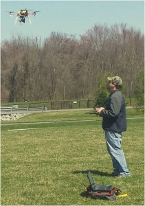
 I’m Dave Firman, a remote sensing professional with a strong interest in UAVs and DIY mapping.
In my professional life I work as the GeoSAR Technical Lead, producing dual band RADAR digital elevation models and imagery. I have been working extensively on the Alaska IFSAR program, producing updated DSM and DTM for a good portion of the state.
I have strong scripting skills in Python and BASH, as well as intermediate Java and C. I am a skilled geoprocessor with both ArcGIS and QGIS, Photoscan and PIX4D.
In my personal life, I have strong interest in UAVs for personal mapping projects and flying in general.